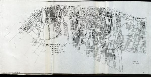
Morphological Map Of Windsor, Ont. 1940
| Morphological Map Of Windsor, Ont. 1940 |
Creator(s): Robinson, J. Lewis |
Year: 1940 |
Type(s): Map Plan |
Language: English |
Source: Windsor, Ontario: a study in urban geography by J. Lewis Robinson; M.A. Thesis, Syracuse University, 1942 |
Notes: Source on map: Can Underwriters Insurance Atlas |
Subject(s): Windsor (Ontario) Construction Houses |
Place(s): Windsor (Ontario) |
Rights: Public Domain |
Repository: University of Windsor. Leddy Library |
| Tiff Image(s): Click links to download Tiff images: Tiff Image 1 |
