Sandwich And Windsor 1879
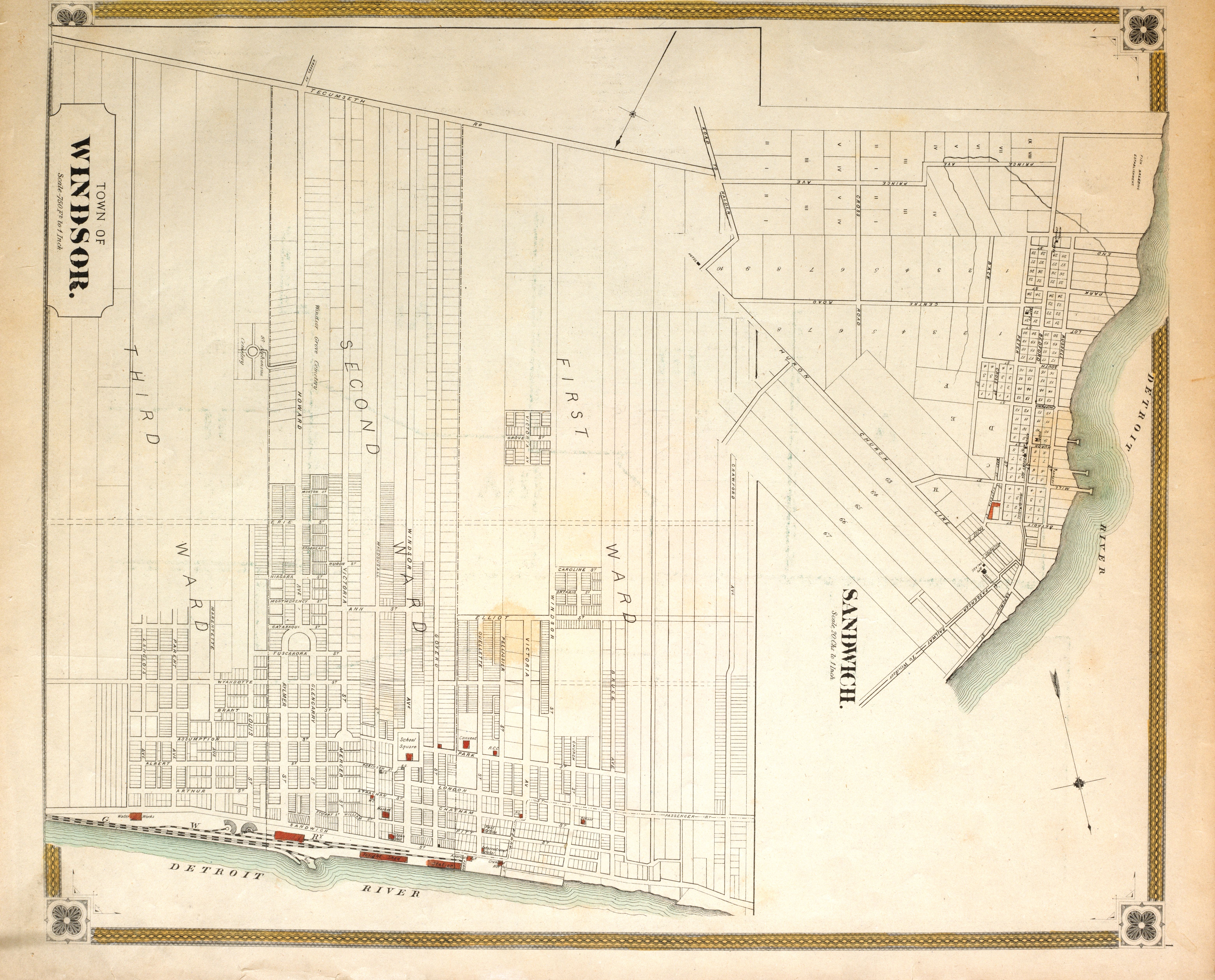 |
| Sandwich And Windsor 1879 |
Year: 1879 |
Type(s): Map Plan |
Identifier(s): G3464.W7 1879 M55 |
Language: English |
Source: The New Topographical Atlas of the Province of Ontario, Canada. Toronto, Ont.: Miles And Co., 1879. Map 1 |
Notes: Town of Windsor: scale is 750 feet to 1 inch; Sandwich: scale is 20 chains to 1 inch; shows the 3 wards of Windsor. |
Subject(s): Windsor (Ontario) Sandwich (Ontario) |
Place(s): Windsor (Ontario) Sandwich (Ontario) |
Rights: Public Domain |
Repository: University of Windsor. Leddy Library |
| Tiff Image(s): Click links to download Tiff images: Tiff Image 1 |